Because of the coronavirus, the concerns of travellers on public transport, especially on the number of passengers, are important. Indeed, it is sometimes difficult for travellers to know whether transports will be crowded. However, it has become essential to stay updated, in order to avoid the risk of contamination. After the display of restaurants delivering or selling take-away food, zoom on the new Google Maps feature that allows you to assess the number of people on the road.
Avoid crowds in transport at all costs
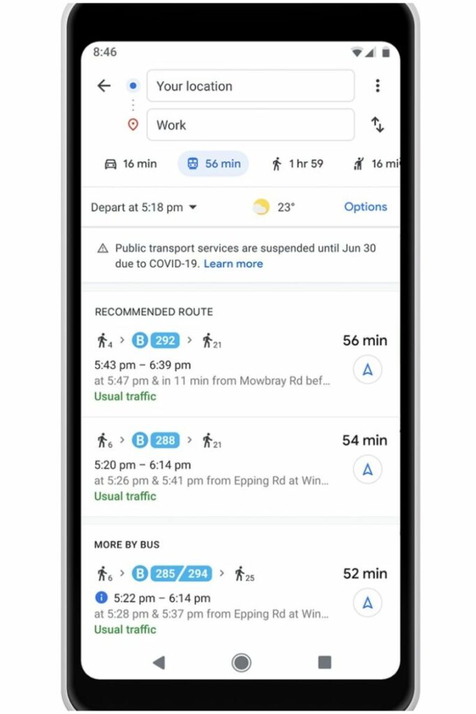
Since the recent update of the Google Maps application, users are now kept informed of the various restrictions that can sometimes occur in public transportation. Google Maps is based on data from local transport operators. These alerts can warn you about the obligation to wear a mask and the removal of certain lines. At this time, these alerts are only available in France, Belgium, Spain, the Netherlands, the United Kingdom, the United States, Mexico, Brazil, Argentina, Colombia, Australia, India and Thailand. A global roll-out is probably planned in the coming days.
However, in the United States, Google Maps has an additional feature. The application provides drivers who wish to cross the border with Canada and Mexico with notifications of checkpoints and other border crossing restrictions.
In addition, in some countries, additional information is available, such as Indonesia, Israel, the Philippines, South Korea and the United States. In these countries, it is possible to have alerts when users visit medical centers or COVID-19 testing centers. Indeed, it will be possible to be alerted on the possibilities to access the centers, as well as to the guidelines of the local health structure. This is in order to avoid overcrowding or being turned away.

Other features to promote social distancing

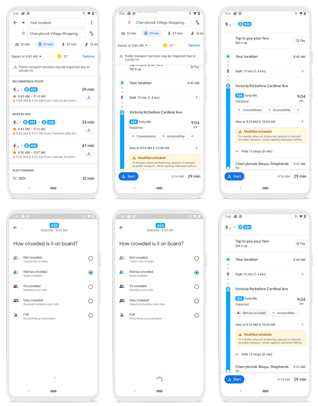
Last year, Google Maps introduced predictions on the use of public transportation. These predictions are based on algorithms fed by data recorded by users. In order to promote social distancing, it is now easier for users to record this data, optimizing these predictions.
Last February, Google Maps implemented new functionalities, with the aim of improving road planning and user experience. Indeed, it is now possible to have information on :
- Accessibility for people with reduced mobility: enable them to know whether the route is accessible, including the possibility of determining whether there is an employee who can assist, the presence of an escalator or lift or whether the “stop” buttons are easily accessible.
- Women-only trains in some parts of the world.
- Security on board: to be aware of the presence of security guards, the presence of cameras or the availability of a hotline.
- Number of cars available: in Japan only, it is possible to know the number of cars available in the subway to increase the chances of having a seat.
Although innovative, it’s most likely that Google Maps’ priority is now to make all its features available everywhere in the world.


